Human-Drone Communication
Demo of human-drone communication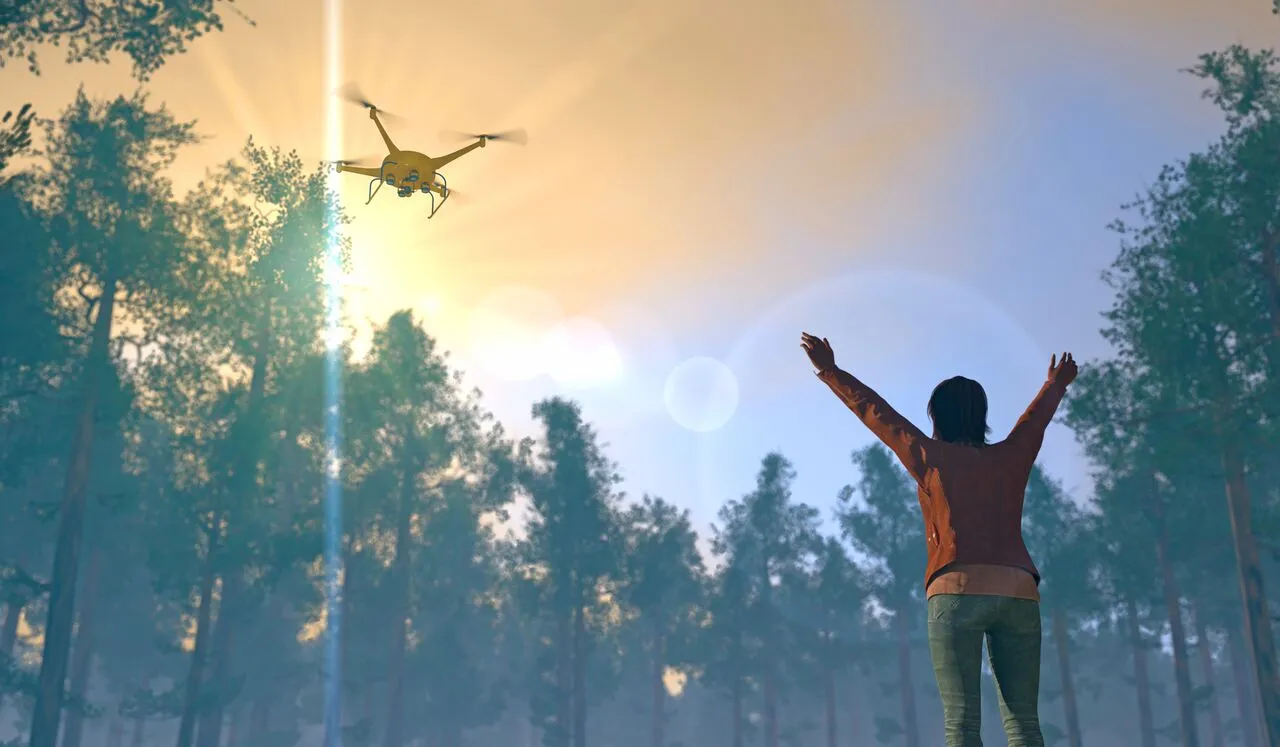

Demo of human-drone communication
Abstract figure from my Remote Sensing 2022 paper 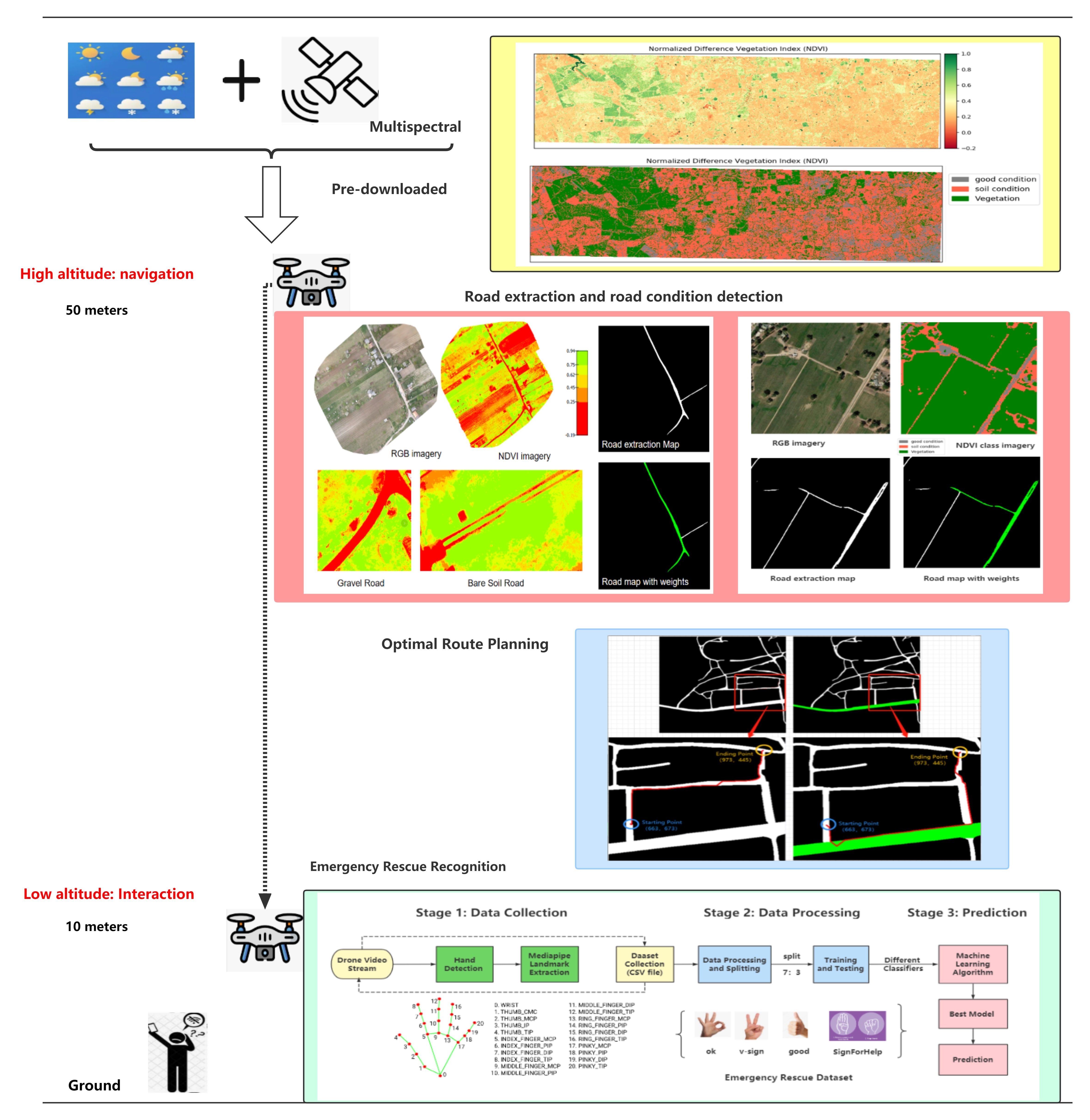
Published in Sensors 21 (6), 2180, 2021
Recommended citation: C Liu, T Szirányi. (2021). "Real-Time Human Detection and Gesture Recognition for On-Board UAV Rescue." Sensors. 21(6):2180. Editor’s Choice Article.
Download Paper | Download Slides | Download Bibtex
Published in Remote Sensing 14 (17), 4355, 2022
This paper proposes a UAV-based method for road condition detection and emergency rescue recognition in wilderness environments.
Recommended citation: C Liu, T Szirányi. (2022). "Road Condition Detection and Emergency Rescue Recognition Using On-Board UAV in the Wilderness." Remote Sensing. 14(17):4355.
Download Paper | Download Slides | Download Bibtex
Published in The 26th IEEE International Conference on Intelligent Transportation Systems (ITSC 2023), 2023
Recommended citation: Chang Liu, Tamas Sziranyi. (2023). " Active Wildfires Detection and Dynamic Escape Routes Planning for Humans through Information Fusion between Drones and Satellites." The 26th IEEE International Conference on Intelligent Transportation Systems . IEEE ITSC 2023.
Download Paper
Published in 17th International Conference on Signal Image Technology & Internet based Systems: IEEE SITIS 2023, 2023
Recommended citation: Chang Liu, Tamas Sziranyi. (2023). "Optimal Wildfire Escape Route Planning for Drones under Dynamic Fire and Smoke." 17th International Conference on Signal Image Technology & Internet based Systems.IEEE SITIS 2023.
Download Paper
Published in IEEE Internet of Things Journal, 2025
Recommended citation: J Hu, S Luo, J Lai, C Liu. (2025). " Enhanced Infrastructure Enabled Perception System Based on Edge Computing." IEEE Internet of Things Journal. vol. 12, no. 11, pp. 16493-16510, 1 June1, 2025, doi: 10.1109/JIOT.2025.3532317.
Download Paper
Published in International Conference on Computer Vision, ICCV 2025 (DriveX) paper id 5, 2025
Recommended citation: Chang Liu, Yang Xu, Tamas Sziranyi. (2025). " D3FNet: A Differential Attention Fusion Network for Fine-Grained Road Structure Extraction in Remote Perception Systems." International Conference on Computer Vision .ICCV 2025.
Download Paper
Published:
This work presents a UAV-based human gesture recognition system for rescue operations. The system can detect, track, and count humans, and recognize ten basic rescue gestures. Special attention is given to dynamic gestures Attention and Cancel, which set and reset communication with the UAV. Using deep learning, the system achieved 99.47% accuracy on training data and 99.09% accuracy on testing data.
Recommended citation: Chang Liu, Tamás Szirányi. Gesture Recognition for UAV-based Rescue Operation based on Deep Learning. IMPROVE 2021, pp. 180-187.
Download Paper | Download Slides
Published:
This work presents an intelligent UAV-based route planning system for field environments. First, roads are extracted from real-time UAV images using D-LinkNet. Then, main and secondary roads are distinguished based on width and real-time road conditions, assigning different weights. Finally, a weighted A* algorithm calculates the optimal route between user-defined start and end points. The approach is validated through simulations on publicly available datasets and provides real-time optimal routes for people in the field.
Recommended citation: Chang Liu, Tamás Szirányi. UAV Path Planning based on Road Extraction. IMPROVE 2022, pp. 202-210, DOI: 10.5220/0011089900003209.
Download Paper | Download Slides
Published:
This work introduces a global multi-temporal satellite dataset to remove clouds and shadows using STGAN. The baseline STGAN achieves PSNR 33.4 and SSIM 0.929, producing high-quality cloud-free images for real-world applications. The dataset is publicly available.
Published:
This talk presents a method for wilderness rescue using UAVs and satellite imagery. The approach integrates UAV vision technology and satellite image analysis for:
Published:
This talk presents a method for optimal wildfire escape route planning specifically for drones, considering dynamic fire and smoke models. The approach includes:
Published:
In this dynamic session, Dr. Chang Liu explores the transformative role of Artificial Intelligence in cutting-edge applications involving satellites, drones, and mobile robotics—specifically autonomous vehicles and robotic dogs.
, Budapest University of Technology and Economics (BME), Department of Networked Systems and Services, 2019
, Budapest University of Technology and Economics (BME), Department of Networked Systems and Services, 2024